The Back Roads To Drift Creek Falls
- Dan Oliver
- Oct 6, 2021
- 4 min read
The hardest part of this hike is the long gravel road drive approaching the trailhead, a twenty minute schlep that's still totally worth it.

Building Bridges
Drift Creek Falls Trail #1378 is a relatively new trail opening for the first time on September 12th, 1997. Before this time the area and the falls were left mostly unexplored other than some adventurous anglers.
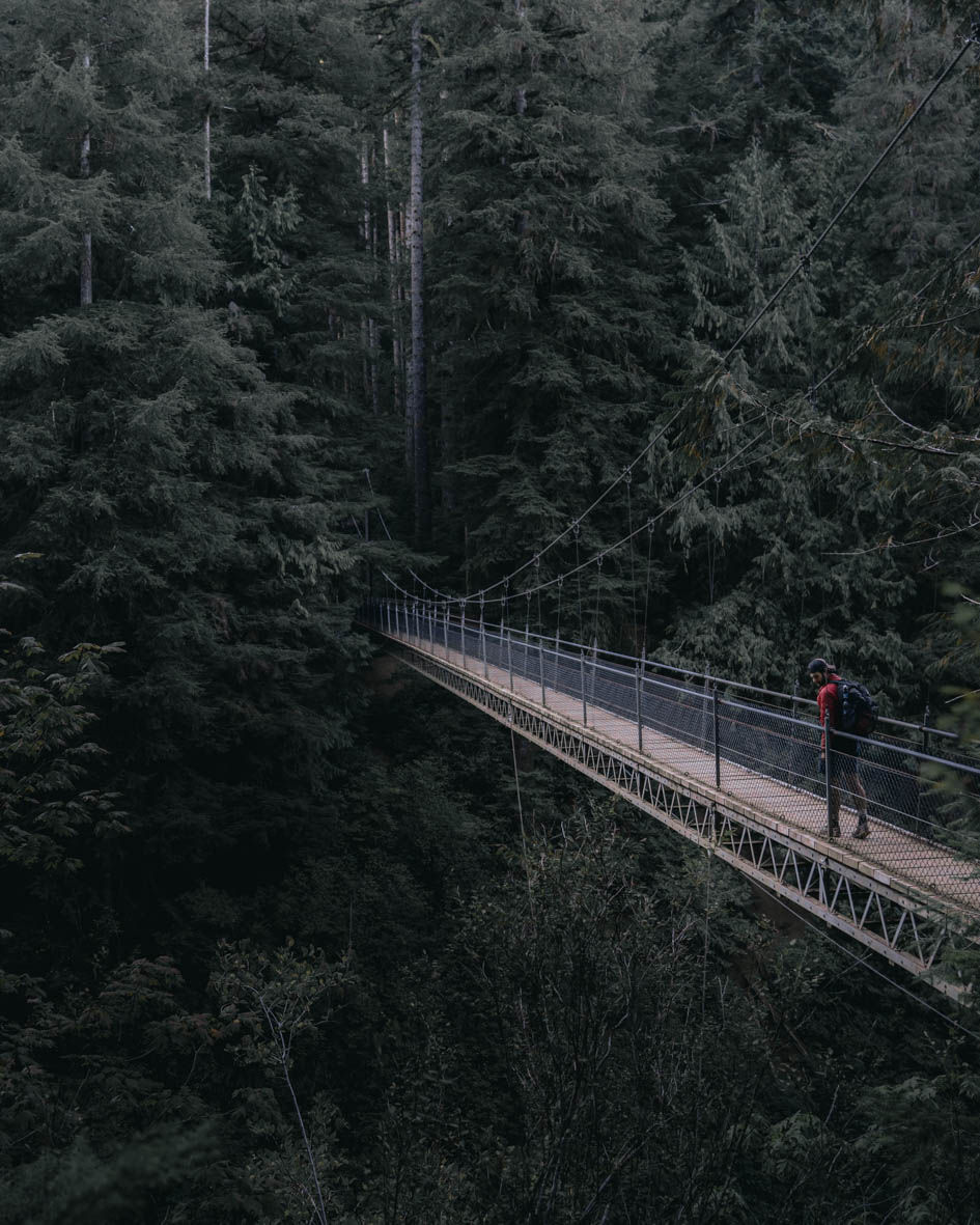
The bridge is built by a Seattle company that specializes in building bridges in remote locations like this. Unfortunately, their company was called to the scene after an accidental death during a US Forest Service bridge building accident.
The bridge serves as a memorial to Scott Paul, the US Forest Service foreman who died at the scene.
The bridge ran a cost of $175,000 and total project costs for the park were $225,000. Even for 1997 these figures seem low but that's what you get when private companies bid accurately on government contracts.

The bridge used materials carried in by workers a quarter-mile away from the nearest forest service road and outfitted special bicycles to haul loads. The heavier materials and concrete were brought in with air support from helicopters.
After everything was finished it concluded the 1989 dreams of the Siuslaw National Forest Rangers and leaves a remarkable trail in Oregon with a unique, one of a kind setting.
You can read more from this 1997 article in the Seattle Times about the construction and opening of this trail here!

About The Hike
The Drift Creek Falls hike is suitable for hikers of all ages and offers something for everyone. The coastal range forest with old growth trees, a massive suspension bridge, and of course a stunning PNW waterfall.
The hike is backwards in elevation meaning that from the trailhead you will descend in elevation until reaching the base of the waterfall.

The trail is an out & back with the option to loop a piece if desired. The out & back distance is a little over three miles with the bridge and the waterfalls being at the far end of this hike.
To get to the base of the falls there are two different ways. The path after crossing the suspension bridge continues to the base or you can head straight towards the waterfalls and use the unmarked trails with some ropes put in for assistance to climb down to the falls.
The falls are always flowing but the flow can be drastically increased in times of heavy rainfall in the spring. You can check some pictures out here of what I mean.
There is no option to continue further along on this hike or connect to other trails in the area.
Drift Creek Falls:
Distance: 3.2 Miles
Type: Out & Back
Ascent: 541 feet

Getting There and Important Information
So everyone in the reviews that I've read love to complain about how long and bad the drive in was.
One review on AllTrails even said as much that they enjoyed the hike but wouldn't recommend it to others because of the drive in. Like okay Karren, it's really NOT THAT BAD.
But that could be her way of trying to keep people away so she can keep coming back for years with less crowds. Who knows, but either way the road is in great condition for being a forest service road into the middle of nowhere.
The closest town is the coastal town of Lincoln City, Oregon which will be about a 40 minute drive out to the trailhead with half of that being on 20mph back roads.
There is a day use fee of $5 to use this area.
There are no signs stating overnight parking and camping are not allowed. I enjoyed a nice car camping spot at the trailhead and started my hike at first light.
Although I had the entire park to myself, I have heard this area does get heavy traffic from the coastal highway tourist.
It is state forest land so any state forest camping rules are to be in effect too.

©Copyright 2020-2021 Secret Hike
Photography exclusively by Dan Oliver unless otherwise stated and cited. Embedded maps are provided by Embed Google Map (embedgooglemap.net) and map images shown are provided as stated and cited.
DISCLAIMER:
This website is provided for entertainment purposes only, and is not meant to serve as an instructional guide, or present itself as an authority for any of the locations written about. The locations mentioned, written, and photographed herein are nothing more than my personal adventure archive. If you are interested in visiting any locations you should not depend on the information in this website to plan any excursions. You should research a wide variety of informational sources, websites, hiking guide books and maps found elsewhere. Many locations are dangerous and potentially illegal to access which can lead to fines, injury or death even when prepared. I do not encourage anyone to trespass or put themselves or others in way of harm. This website, and therefore its’ owner/author, cannot assume any responsibility for anything you may incur while hiking or exploring any of these locations or anywhere on planet earth. Thank you for viewing!


Comments